What is the highest contour line in the mapped area?
...
What is the highest contour line in the mapped area?
400 metres
600 metres
500 metres
300 metres
Correct answer is C
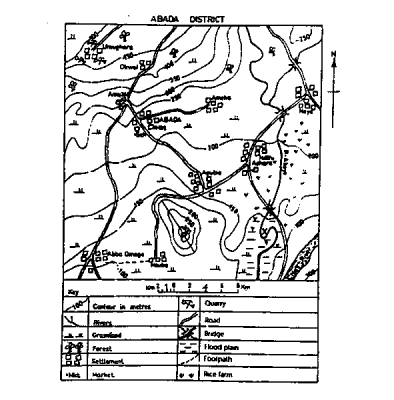
On the map, the highest contour line is 500m
Similar Questions
Low population densities of the middle belt of West African countries can best be described as ...
The most outstanding maize-growing area of Nigeria is the? ...
Which of the following is a major boost of tourism? ...
The process of weathering include all but one of the following ...
The movement of the earth that causes variation in the length of the day and night is ...
The dust particles over which moisture settles when condensation takes place is known as ...
Low birth rate and low death rate are characteristics of? ...
Which of the following phrases best describes the entire area on the right bank of River Ere? ...